Recently Google and RapidKL manage to include Kuala Lumpur public transport information in Google Maps.In other words, now residents in Klang valley can start to enjoy Google Transit on Google Maps.
You can use Google Transit to
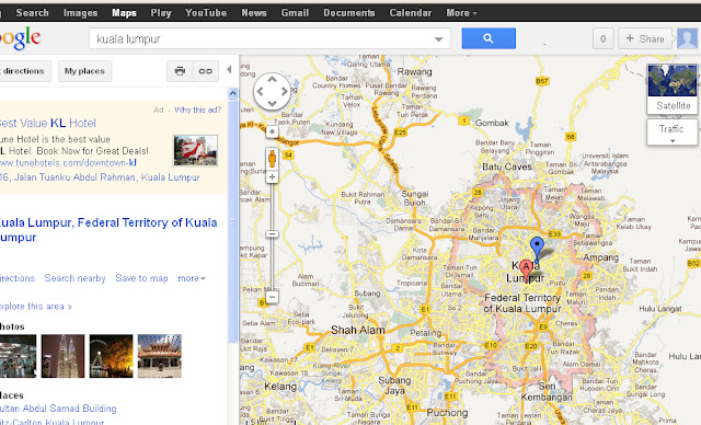
First, you need to open Google Maps and scroll to Klang valley. You can do that by typing Kuala Lumpur in the search box as well.
http://maps.google.com.my/
![]()
Let say you want to go from Terminal Bersepadu Selatan (TBS) which is the south bound bus terminal, to UTAR Setapak.
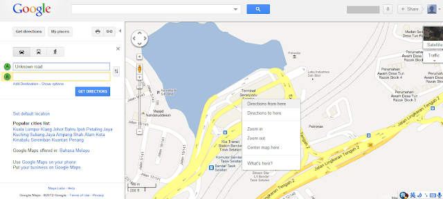
1. Zoom the map to TBS. If you not sure where is TBS on the map, just type TBS at the search box.
![]()
2. Then, right click on TBS (anywhere near TBS), and choose "Direction from Here"
![]()
3. Then, scroll to UTAR Setapak (Type on the search box to search if you not sure), and right click, then select "Direction to here"
![]()
4. So now you get the driving direction between the two places
![]()
5. If you familiar with Google Maps, you will realise a new transit icon has been added to Google Maps Malaysia as in other countries where public transport is something normal.
![]()
6. Click on the transit icon and you will get the information of traveling using public transport.
![]()
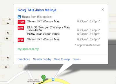
7. Bus stop location, routes information and estimation of arrival time are now available (it was 6.00pm when I post this, so you will see different time when you try). Good Luck!
![]()
You can use Google Transit to
- Get step-by-step transit directions
- Find transit stops in your area
- View station information and schedules
First, you need to open Google Maps and scroll to Klang valley. You can do that by typing Kuala Lumpur in the search box as well.
http://maps.google.com.my/
Let say you want to go from Terminal Bersepadu Selatan (TBS) which is the south bound bus terminal, to UTAR Setapak.
1. Zoom the map to TBS. If you not sure where is TBS on the map, just type TBS at the search box.

2. Then, right click on TBS (anywhere near TBS), and choose "Direction from Here"
3. Then, scroll to UTAR Setapak (Type on the search box to search if you not sure), and right click, then select "Direction to here"

4. So now you get the driving direction between the two places

6. Click on the transit icon and you will get the information of traveling using public transport.
7. Bus stop location, routes information and estimation of arrival time are now available (it was 6.00pm when I post this, so you will see different time when you try). Good Luck!